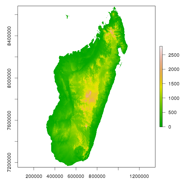
Environmental data can be downloaded as a multilayer raster GeoTIFF (.tif) file. Projection is WGS 84 / UTM zone 38 (epsg: 32738) and resolution is 1km on an extent covering Madagascar. Data type is INT16 (16-bit integer value) with -32768 set as no value. The raster has 9 layers (named from environ.1 to environ.9) and an approximate size of 5 Mo. Layers describe the following environmental variables:
| Layer | Environmental variable |
|---|---|
| 1 | Altitude (m) |
| 2 | Slope (in degree) |
| 3 | Aspect (clockwise from North, in degree) |
| 4 | Solar radiation (Wh.m-2.day-1) |
| 5 | Geology (Kew Botanical Garden, 1997) |
| 6 | Soil (Pelletier, 1981) |
| 7 | Vegetation (Kew Botanical Garden, 2007) |
| 8 | Watersheds (Pearson, 2009) |
| 9 | Percentage of forest cover for the year 2010 (%). |
The raster file can be easily imported into any GIS software. If you use R and the raster package, you can import the raster and rename the 9 layers with the following piece of code:
library(raster)
s <- stack("environ.tif")
names(s) <- c("alt","slop","asp","solar","geol","soil","veg","wshed","percfor2010")
Then you can plot the altitude for Madagascar for example:
par(mar=c(3,3,1,1))
plot(s$alt,col=terrain.colors(255))

